|


|
|


 ()
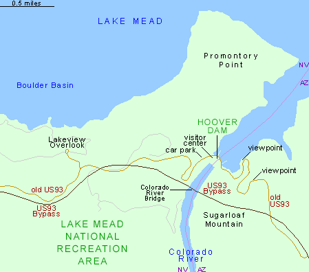
() The three main components of the project are 2 miles of new road in Arizona, 3 miles in Nevada, and the bridge itself (The Bridge is 1,900 feet long), 900 feet above the river. The current road will then be used solely for visitors to the dam, and the section across the top will be closed to public vehicles.
This will bypass more than 5.4 miles of the distance via the old route and save time for commercial traffic in need of this route. Trucks and transports are currently routed South through Laughlin. Would that be the Bypass - Bypass?
Link is to source page. http://www.americansouthwest.net/arizona/lake_mead/hoover_dam.html
Still searching for the answer to how much distance it will save? If I get bored maybe I can do a mapquest route and see how long it is between points now, and "guestimate" the 5-6 miles in the middle using the bypass? 
Congress has already named it the Mike O'Callaghan-Pat Tillman Memorial Bridge.
Bridge site page: http://www.hooverdambypass.org/
|
|